The USDA Forest Service Upper Peninsula Fire and Aviation Management Unit is preparing for prescribed fire operations on the Hiawatha and Ottawa National Forests. This includes 7,042 acres on the East Zone and 3,248 acres on the West Zone of the Hiawatha National Forest, and 587 acres on the Ottawa National Forest.
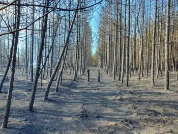
These prescribed fires reduce risk to the public by removing hazardous vegetation to mitigate wildfires and prevent loss of property. They also help to re-establish fire’s positive role in local ecosystems, increase native plant regeneration, and improve wildlife habitat and forest health.
During active burning, smoke and flames may be visible from roads and in areas downwind of the burn site. Go to https://fire.airnow.gov/ for information about air quality or contact your nearest Ranger District to be notified of prescribed fires in your vicinity the day of the burn.
Visit https://inciweb.wildfire.gov/ for updated information or find contact information for your local Ranger District office at the websites listed above. An online map of this plan is also available at https://usfs.maps.arcgis.com/apps/instant/sidebar/index.html?appid=0b202f990a244b669a85acff82bc66c5


Comments